Toggle navigation
Menu
About
Work
Resume
Contact
Projects
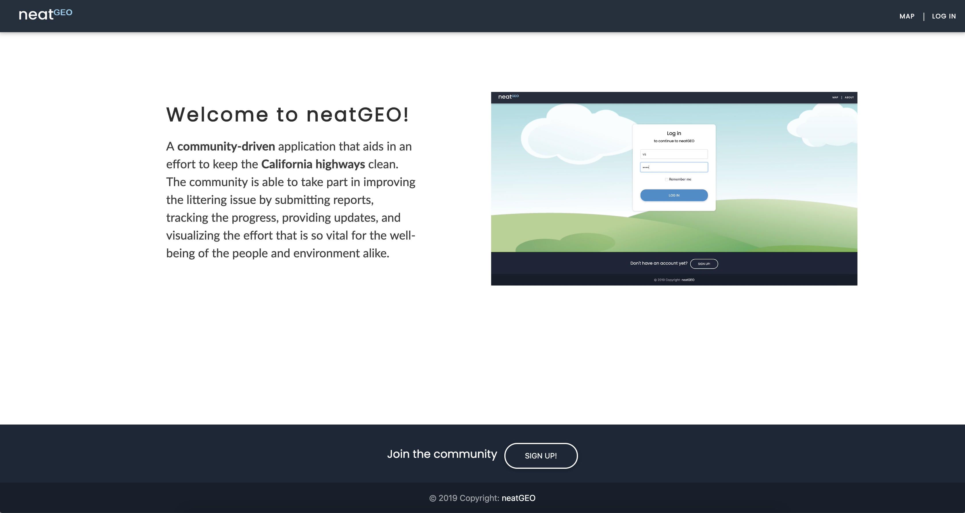
neatGEO Web Application - Practicum in GIS Development @ UW-Madison.
Developed with:
Mapbox GL JS, JavaScript, D3, Java, Java Servlet, JDBC, PostgreSQL/PostGIS, HTML, CSS, and Bootstrap.
Acadia National Park Web Application - Capstone Project in GIS Development @ UW-Madison.
Developed with:
Mapbox GL JS, JavaScript, Java, Java Servlet, JDBC, PostgreSQL/PostGIS, HTML, CSS, and Bootstrap.
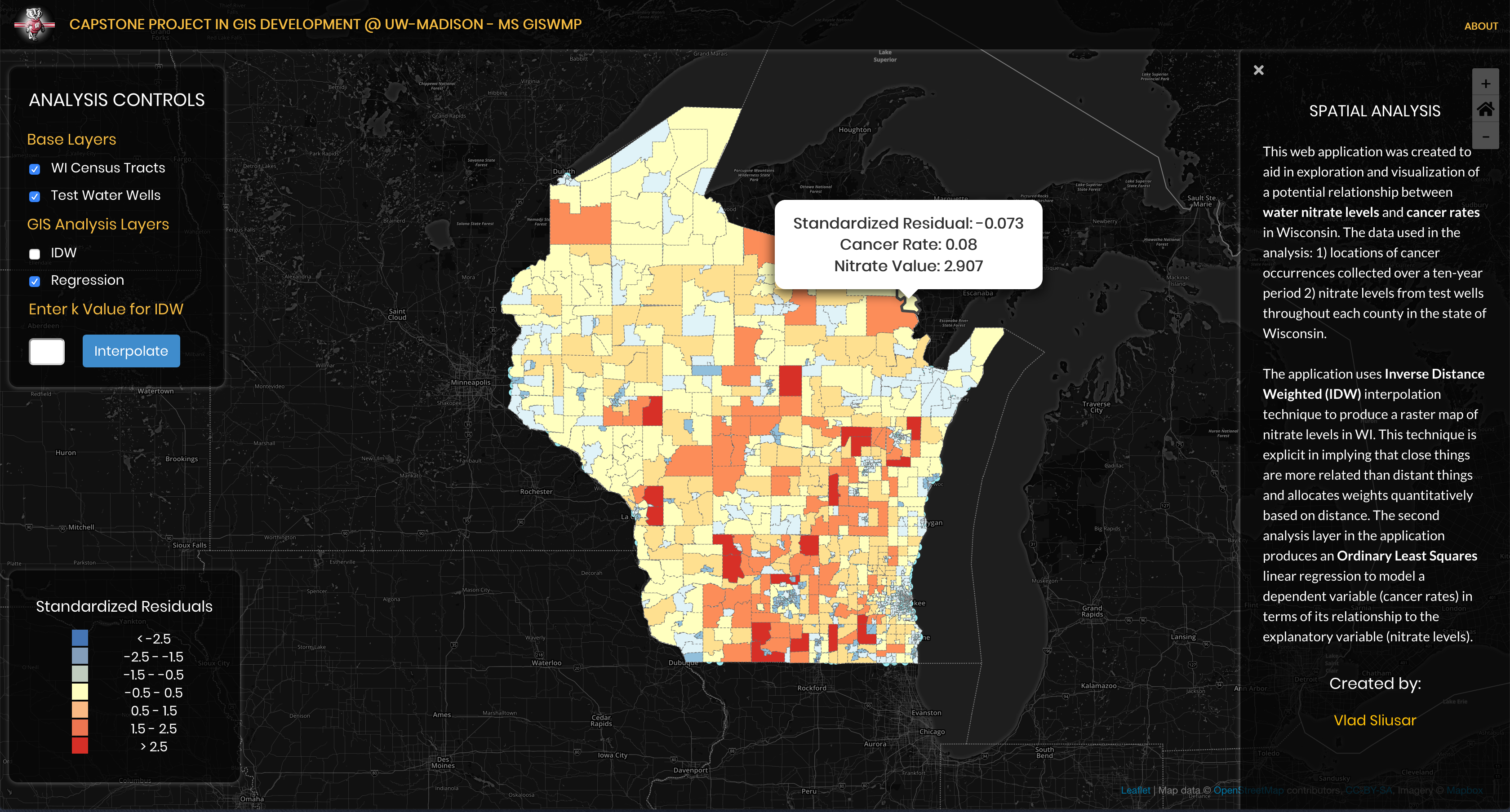
Spatial Analysis - Capstone Project in GIS Development @ UW-Madison.
Developed with:
Leaflet, JavaScript, jQuery, Turf.js, Grid.js, Chroma.js, HTML, CSS, and Bootstrap.
Interactive analytical tool.
Created with:
D3, JavaScript, jQuery, and Bootstrap.
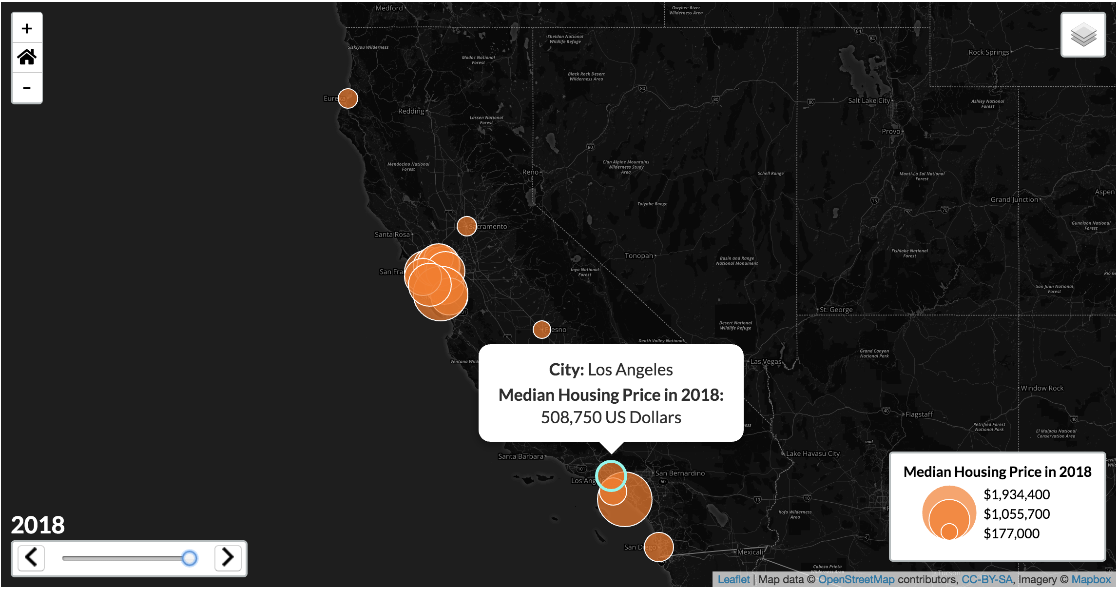
Coordinated visualization with D3.
Created with:
JavaScript, D3, jQuery, and Bootstrap.
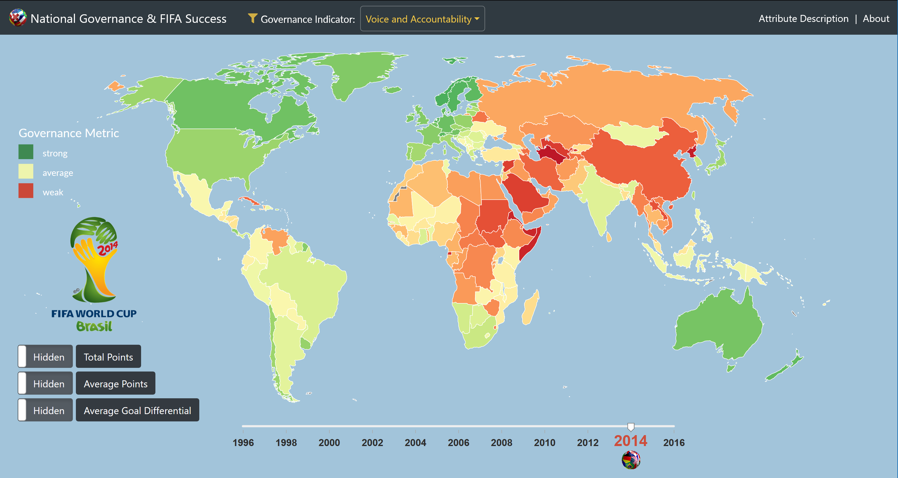
Interactive spatiotemporal proportional symbol map.
Created with:
JavaScript, Leaflet, jQuery, and AJAX.
A custom web map tileset inspired by the animated Pixar film "UP".
Created with:
Mapbox Studio, Photoshop, and Illustrator
Research Project - Effectiveness of SF311 Service.
Completed with:
Python, PostgreSQL/PostGIS, SQL, ArcGIS, ERDPlus, and Excel
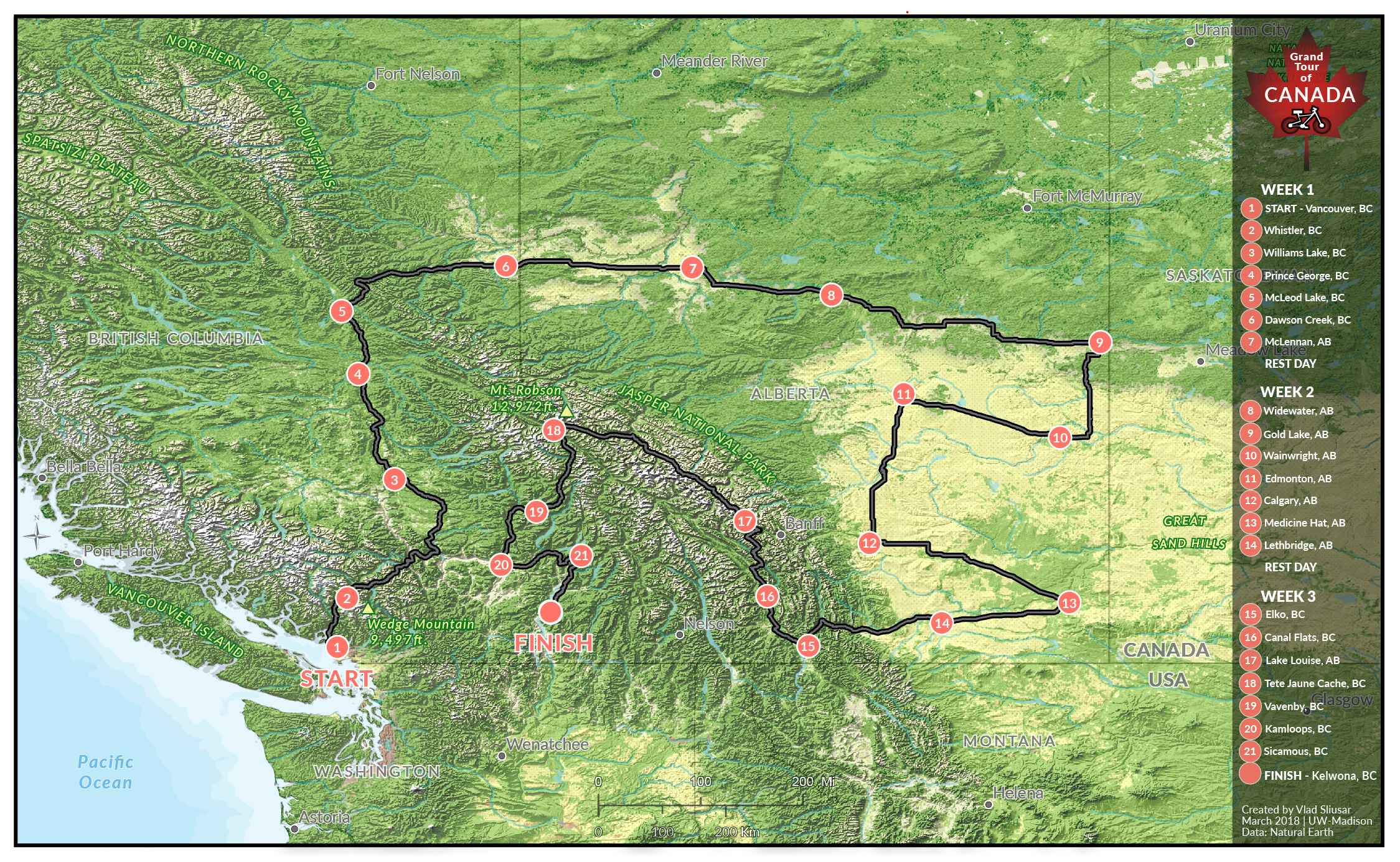
Shaded relief map of Bicycle Grand Tour of Canada.
Created with:
ArcGIS, Photoshop, Illustrator, and Google Earth Pro
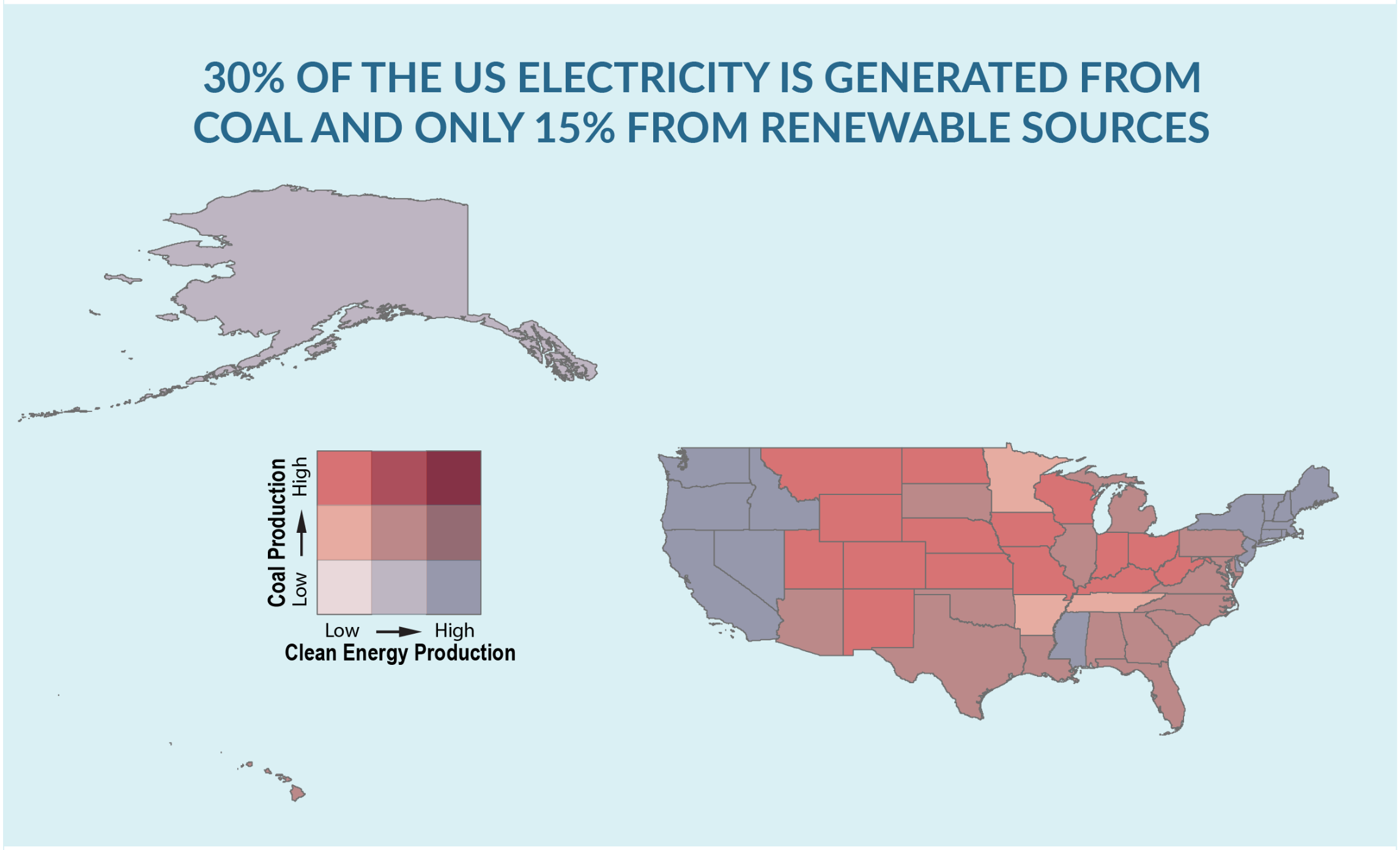
Visual Storytelling - Longform Infographic.
Created with:
ArcGIS, indiemapper, and Illustrator.
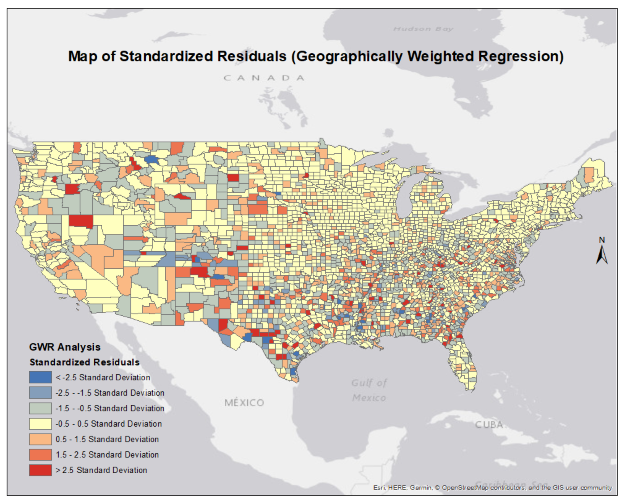
Geographically Weighted Regression Analysis of Homicide Rates in the US.
Completed with:
ArcGIS - Spatial Statistics.
Research Project for GEOG 690 (Senior Seminar in Geography and Environmental Science) at SFSU.