Research Project - Effectiveness of SF311 Service
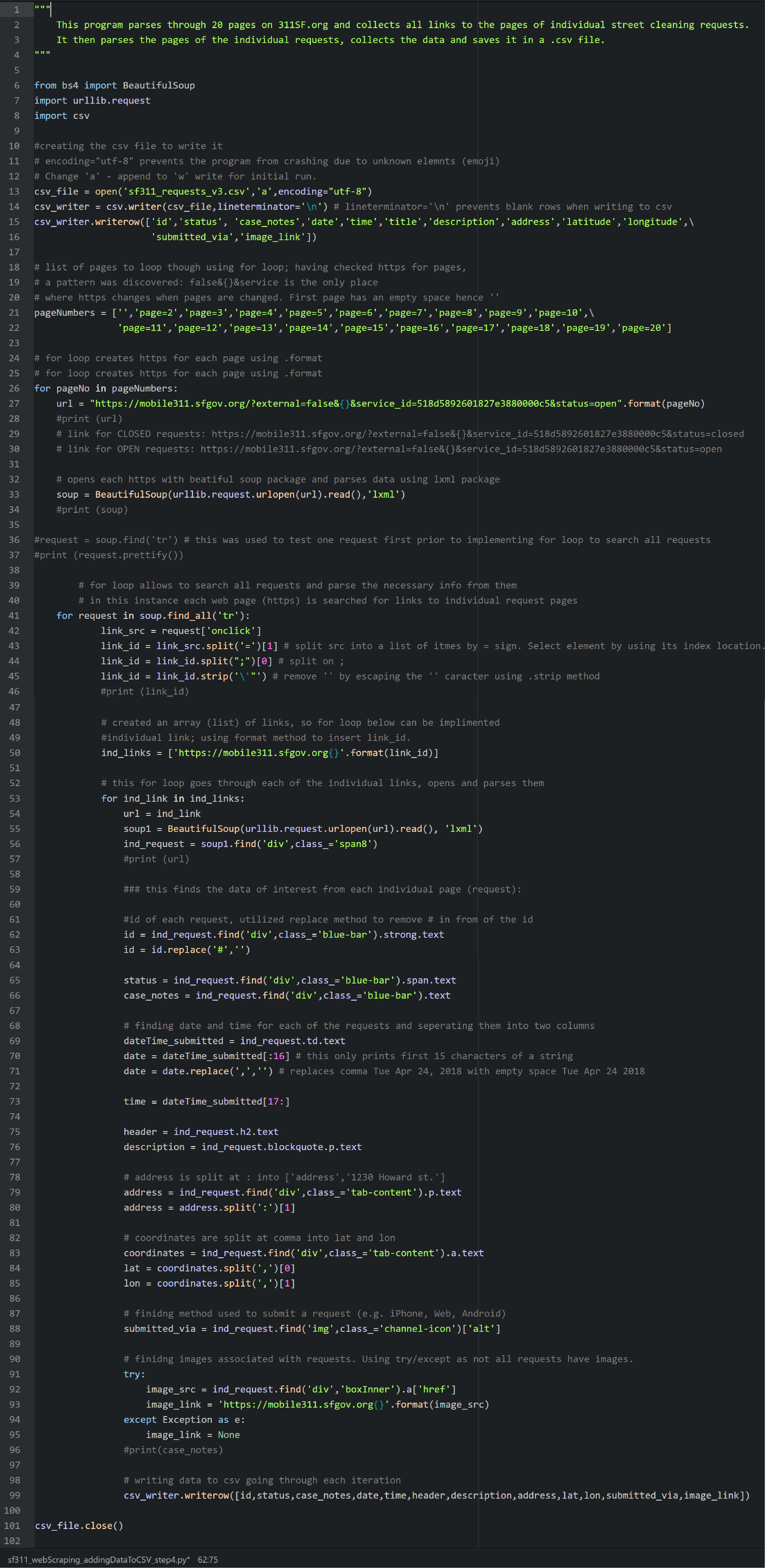
This project is related to geodatabase development and implementation. More specifically, the research utilizes a geospatial database along with PostgreSQL/PostGIS and ArcGIS to consider the capability of the San Francisco's 311 platform. The platform serves as a tool to accept, process, and address various requests from the community, such as requests for city street cleaning. The research consists of the following steps: data collection via web scraping (Python), geospatial database design, utilization, and storage (ArcGIS), conceptual and logical models design and implementation (ERDPlus and PostgreSQL/PostGIS), data query (SQL), and map creation.
Below is the web scraping python program that I wrote for this research. The complete project may be found here.