Terrain Representation Challenge
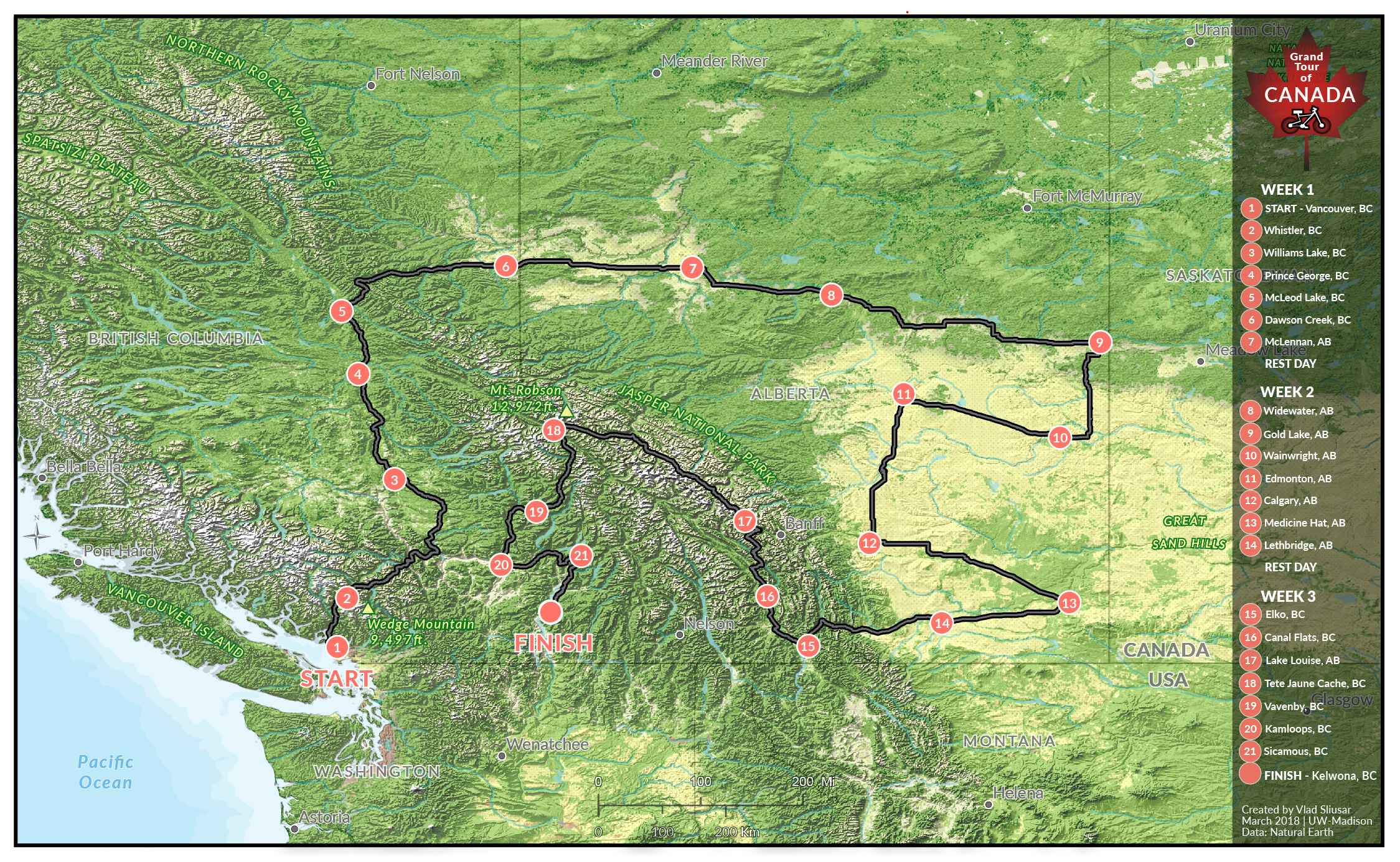
An assignment for my Graphic Design in Cartography class at UW – Madison was to create a promotional map for the newly introduced International Bicycle Championship Tour. The duration of the tour is 21 days with a rest day once a week. The project was comprised of the following steps: propose and create a route, gather and process vector and raster (DEMs, land cover) datasets, style shaded relief and vector layers, and combine all layers uisng visual hierarchy.
Created with: ArcGIS (including 3D Analyst & Spatial Analyst extensions), Google Earth Pro, Photoshop, and Illustrator.